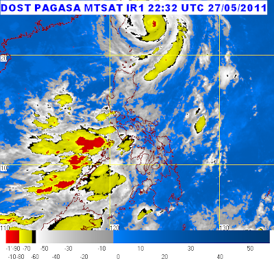
Bagyong Chedeng (Typhoon Songda) "continues to weaken", the Philippine Atmospheric Geophysical and Astronomical Services Administration's (PAGASA) latest bulletin reads.
Heading north northeastward at a rate of 22 kph, Tropical Storm Songda was last seen at 200 km Northeast of Basco, Batanes at 4 a.m. on May 28, 2011.
The weather disturbance now has a "maximum sustained winds of 165 kph near the center and gustiness of up to 200 kph."
By Sunday morning, "Chedeng" is forecast to be at 680 km Northeast of Basco, Batanes or
110 km South of Okinawa, Japan.
Public Storm Warning Signal (PSWS) Number 3 has also been lifted over Batanes Group of Islands which is now the only one listed on areas with PSWS Number 2. PSWS Number 1 was hoisted over Calayan and Babuyan Group of Islands. All PSWS elsewhere are now lowered.Source URL: https://celebrityvma2011.blogspot.com/2011/05/bagyong-chedeng-typhoon-songda-may-28.html
Visit celebrity vma 2011 for Daily Updated Hairstyles Collection


No comments:
Post a Comment